
There is an undoubted air of mystery about Ramu, the small riverside market town near the coast, about 15km from Cox’s Bazar.
With its ancient wooden temple, and old riverside market site it already raises questions about its history.
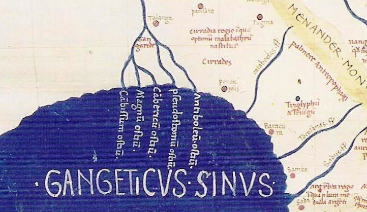 |
| South-East Asia from Ptolemy's geography. Redrawn in the 15th century. The British Library Harley MS 7182. |
However, the mystery deepens. A close scrutiny of the 2nd Century map of the Ganges Delta and the lands around Bay of Bengal, besides revealing the certain knowledge passed to Ptolemy, the Greek cartographer whose maps of the known world show a remarkable knowledge of coastal detail, show, half way between two rivers easy to interpret as the Karnaphuli and Naf rivers, a settlement called Ramu, or Ramcu, depending on your reading of the name.
What is extraordinary is that the map marks a number of ancient , mostly more inland settlements, the names of none of which can be recognised to connect with existing places, not even those, such as Sounagora, or modern Wari Bateshwar, that we know existed at that time.
It is believed that Ptolemy’s maps were based on information given him by Pheonician traders, from historic lands in Lebanon. It is possible that Ramu has been a coastal town, even a port, for two thousand years, and under the same name?
It would certainly take a great deal of research and probably excavation to answer the question, and with so much ancient history revealing itself across the country these days, it may, or may not, be a useful priority.
But until we know more, the question is bound to nag at the conscious of anyone interested.
No comments:
Post a Comment